Geography Art
Modeling and Materializing Terrain and Cityscapes
Lidar to 3D Model
Drag and resize the green rectangle on the map to select an area of downtown Vancouver, then click the button to download a print-ready STL.
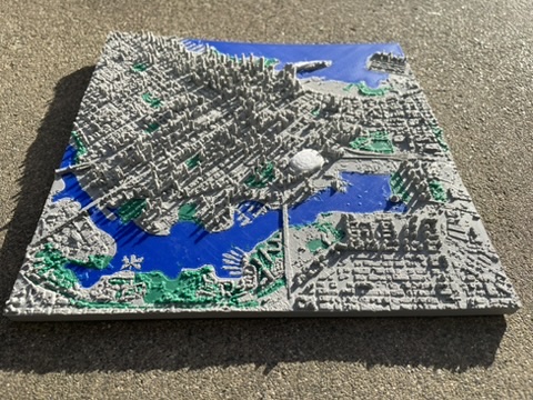
Raw LiDAR data provided by the City of Vancouver Open Data Portal under the Open Government Licence – Vancouver.
Portfolio
3D Printed Vancouver BC from Converted LiDAR
Raw LiDAR data provided by the City of Vancouver Open Data Portal under the Open Government Licence – Vancouver.
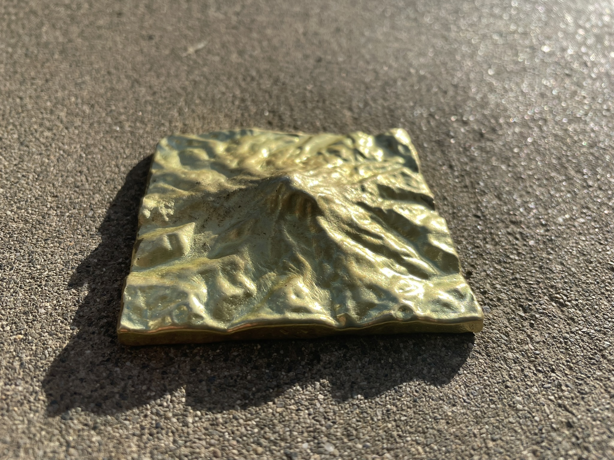
Cast Brass Mount Rainier
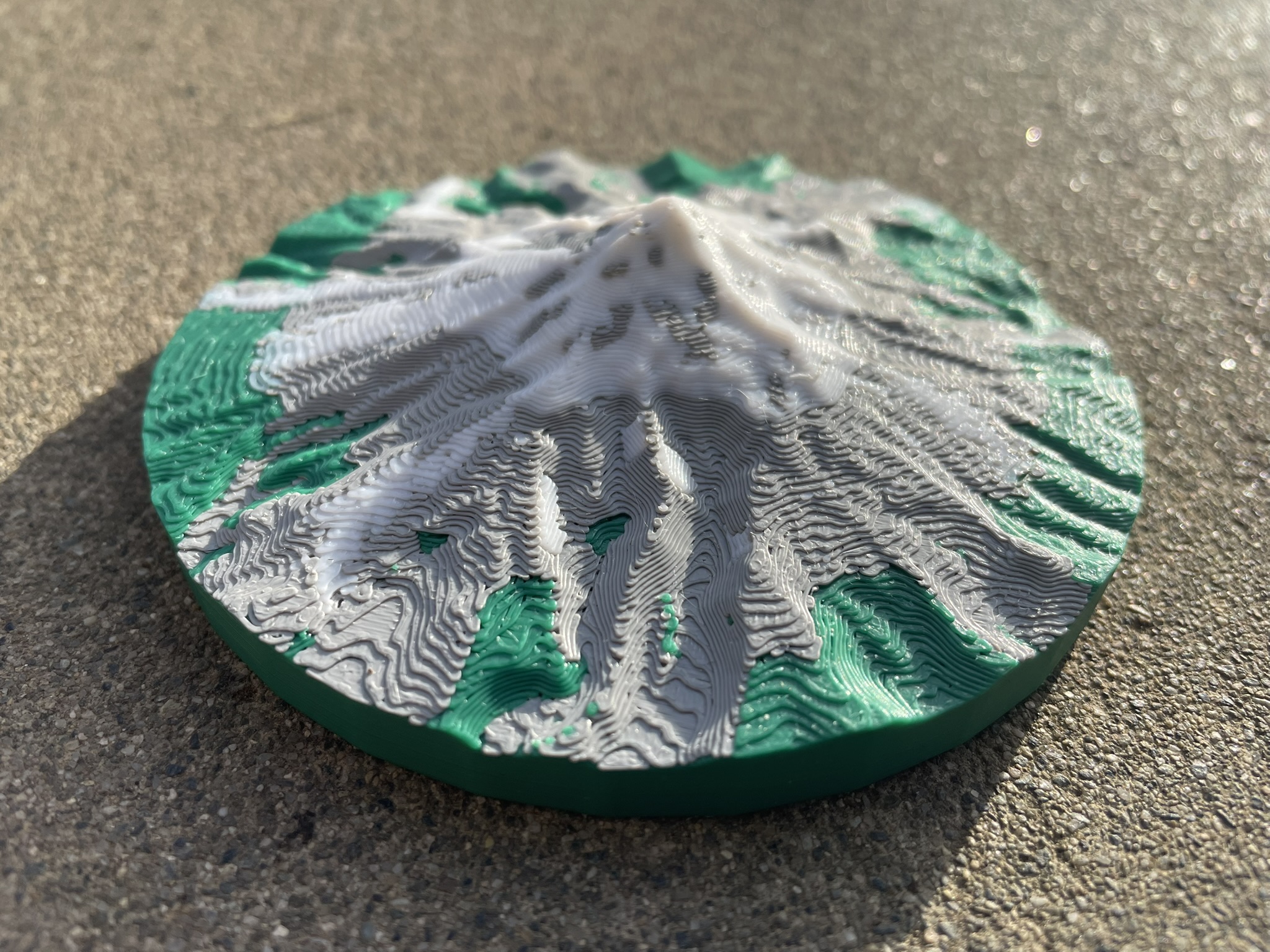
Terrain base model generated with TouchTerrain. Harding, C.; Hasiuk, F. TouchTerrain — 3D Printable Terrain Models. ISPRS Int. J. Geo-Inf. 2021, 10, 108. https://doi.org/10.3390/ijgi10030108
3D Printed Mount Hood with Circular Base
Terrain base model generated with TouchTerrain. Harding, C.; Hasiuk, F. TouchTerrain — 3D Printable Terrain Models. ISPRS Int. J. Geo-Inf. 2021, 10, 108. https://doi.org/10.3390/ijgi10030108
About Me
I'm a full-stack developer passionate about bridging the physical and digital worlds — turning raw geographic data into tangible objects you can hold in your hands.
The Work
The LiDAR to 3D Model project at the top of this page is my most technically ambitious creation. Processing gigabytes of raw point cloud data into a clean, print-ready STL involves a surprising amount of engineering. Beyond automated pipelines, I also work hands-on in Blender — designing molds for CNC-milled graphite blocks used in metal casting, cleaning up photogrammetry scans, shaping custom bases, and whatever else a project demands.
The Workshop
For 3D printing I run a BambuLabs P1P with an AMS for multi-material work. On the casting side, I have a TOAUTO 5 KG electric furnace for lower-temperature metals, and I built a forced-air charcoal furnace from firebricks capable of melting copper. That furnace is currently out of commission — I'm replacing it with a waste-oil furnace that should reach cast iron temperatures.
Get in touch — lucas@geographyart.com